
South Windsor Neighbors and Block Sources
A South Windsor neighbor lookup works by matching the question to the record. GIS answers which parcels touch or sit near an address. The Assessor answers who is assessed and where tax mail goes. Deeds answer who conveyed an interest. A voter result can confirm one registration match, while a directory or census may show an earlier household. Civic pages provide public contact routes, not private member lists.
| Source | What It Shows About Neighbors | Access |
|---|---|---|
| MapXpress GIS parcels | Adjacent geometry, accounts, parcel popups, streets, and layers | Public map and abutters tool |
| Assessor cards | Owner, mailing line, situs, use, value, and building fields per parcel | Vision and town GIS |
| Town land index | Transfers and interests across nearby parcels | RECORDhub; paid images or counter fallback |
| SOTS voter lookup | One qualifying registration result and polling information | Public lookup; no block browse |
| Voter file | Regulated statewide data for permitted civic analysis | Written request; $300 CSV and use limits |
| Directories and census | Earlier street occupants, household composition, and local context | State Library, HeritageQuest, Wood Memorial, or archives |
| Civic and congregation pages | Public organizations, events, and contact routes | Town boards, churches, and community pages; no member roster |
The table's limits matter. A buffer can return mailing records for parcels, and a voter result can be suppressed. Neither one tells how many people are physically present on a block.
South Windsor Neighbors and MapXpress
MapXpress uses a parcel click as the starting point for nearby land. Open the South Windsor interactive map, search by house number and street, name, or account, and choose Parcel Information. The popup can open details, a property card, Vision, FEMA, quick map, and street view. The Generate Abutters control uses a distance input set to 100 Ft by default and runs a spatial-intersection query against the town parcel layer.
- Locate the known address and save its account, situs, owner field, and the date of the map search.
- Click the parcel and open the popup, then note the adjacent parcel shapes and account links.
- Choose Generate Abutters, review the default 100 Ft distance, and select Find Abutters after changing the distance only when the research question requires it.
- Open each returned parcel popup and compare owner, mailing, location, land use, and zoning fields.
- For a full named-road record chain, move to the South Windsor street directory workflow instead of extending a block buffer.
The spatial result means parcels that intersect the chosen buffer. It does not mean every building, person, or household within the distance. Write down the distance, map scale, visible layers, and search date so the result can be repeated.
The MapXpress capture shows the parcel viewer, map controls, aerial choices, and the local context used for a neighbor search.
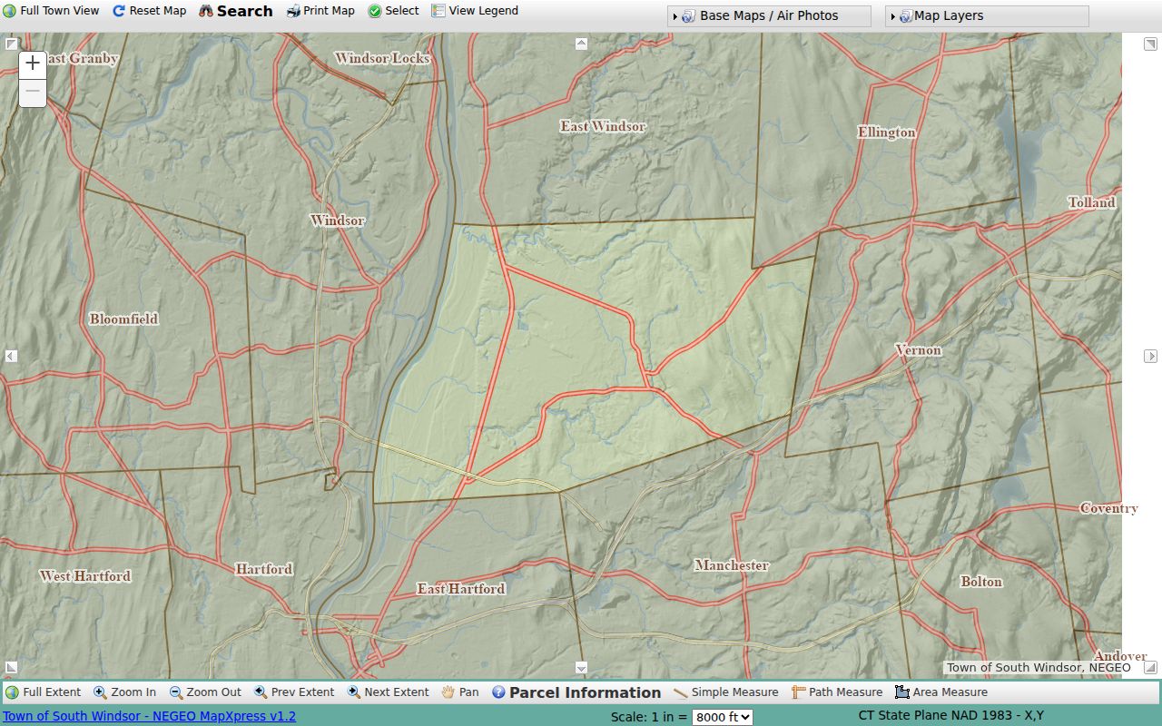
Use the viewer to identify parcels and nearby neighbors first, then use the custodian record for any ownership or address claim.
South Windsor Parcel Popups and Layers
The parcel popup can expose owner, account, location, acres, land use, zoning, and links to Details, Quick Map, Property Card, Vision, FEMA, and Street View. A popup is a property-information aid. The town GIS material says it is not a legal description, survey, conveyance, or boundary certification. Verify a boundary with the recorded map or deed.
Turn on only the layers that help answer the block question. Address Points, zoning, voting districts, school districts, historic districts, landmarks, FEMA, wetlands, open space, elevation, utilities, and pavement add context. Aerial choices include 2023, 2019, 2016, 2012, 2009, and 2005 color layers, plus 1966, 1956, and 1946 black-and-white layers. Aerial years show physical context, not ownership for that year.
Parcel geometry can change with a subdivision, lot split, road work, or map correction. Save the account and legal-description terms with the screen view. If a neighbor question turns into a deed question, use the Town Clerk's grantor and grantee index rather than treating a map popup as a conveyance.
South Windsor Neighbors: Mailing Lists, Owners, Occupants
MapXpress also exposes Generate Mailing List with a default 100 ft distance and a Submit control. That output is a parcel and mailing list. It can help identify which tax correspondence lines sit near the selected parcel, but it is not a resident list and does not prove who occupies a building.
The Assessor owner field, a mailing line, a situs, a deed party, a voter residence, and a directory address each answer a different question. An owner can use another mailing line. An organization can own a site. A registered voter can be inactive or recently moved. A historical directory can name an occupant who was not the recorded owner. Keep those roles distinct in notes and captions.
For a current ownership question, save the account and property card, then confirm a transfer in RECORDhub. For a person question, add a separate voter, business, license, court, probate, obituary, or directory source only when its fields support the match. No public source reviewed supplies a complete list of South Windsor neighbors on a block.
South Windsor Voter Block Visibility
Connecticut's centralized voter system can confirm registration status, party, polling place, district information, and participation fields where displayed. The public SOTS lookup is a person and town search, not an ordinary street or block browse. A result may suppress an address or show only birth year, and protected voters do not become visible through a map buffer.
The full voter file is a different route. The written request form lists a $300 CSV order and purpose certification. Current rules limit use to election-related, scholarly, journalistic, political, or governmental purposes and prohibit personal, private, commercial, advertising, solicitation, marketing, and harassment uses. The file is regulated data, not a general neighborhood download.
Registration and ownership must be compared, not merged. A person may register at an address without owning the parcel, and an owner may not be a registered voter there. If a public election record is not online, the South Windsor Registrar can explain inspection or copy access, subject to protected-voter rules and Connecticut FOIA exemptions.
South Windsor Neighbors and Civic Contacts
Public community routes can help with an event, neighborhood history, or organization contact without exposing a member roster. The town boards and commissions inventory and useful-websites material identify the organizations below. A public contact page can corroborate that a group exists or provide an event route; it cannot be used to infer who belongs to it.
| Public route | What it can provide | Boundary |
|---|---|---|
| Town boards and commissions | Public meeting, office, planning, library, historic, and commission contacts | Organization route, not a neighborhood roster |
| Chamber, Community Band, Community Chorus, Community Foundation | Public events, programs, and contact forms | No private member export located |
| Jaycees, Little League, and Wapping Fair | Public season, event, or volunteer contact route | Use the listed organization contact only |
| First Congregational, Wapping Church, and other congregations | Public service, event, and history contact route | No member directory located |
| Chase Orchards Homeowners Association | Public community contact page | No verified public member directory |
Connecticut eLicense can verify a public credential or business identity when a community contact is also a licensed organization. It is not a civic membership list.
The official Connecticut eLicense lookup is the source for that narrow check.
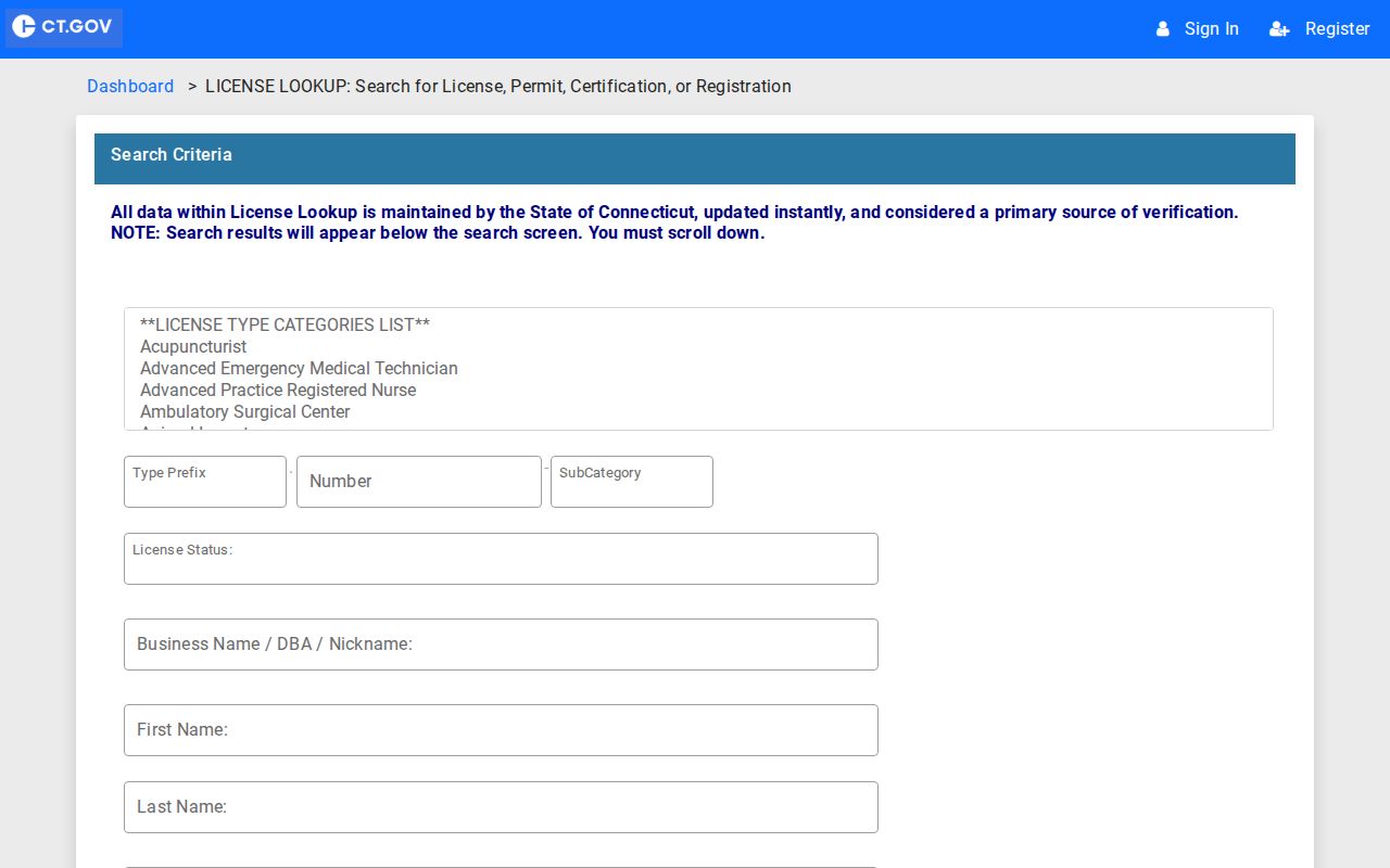
The eLicense capture illustrates a credential route that can verify a public organization detail without supplying private neighbor information.
South Windsor Historic Neighbors and Clues
Current blocks often sit on older place names. Main Street, East Windsor Hill, Wapping, Long Hill, Vinton Mills, Buckland, Pleasant Valley, and Route 5 or John Fitch Boulevard are useful tokens in directories, maps, churches, newspapers, and historic surveys. South Windsor became separate from East Windsor in 1845, so an older neighbor may be recorded under Windsor or East Windsor.
Regional directories, the 1850 and later census schedules, Wood Memorial records, and State Library guides can show earlier streets and households. Census geography is not a modern parcel block, and a directory address may be regional rather than exact. Pair a historical clue with a legal description, map, or dated property card before describing it as the same block.
The South Windsor Historic District Commission bibliography names the 1855 Smith map, 1869 and 1931 atlases, 1911 rural-delivery mapping, and 1934 aerial material. These are fallback sources when a present street line does not match the old record.
South Windsor HOA Directory Gap
Research located a public Chase Orchards Homeowners Association contact page, but no verified public member directory. The same gap applies more broadly: no town-maintained neighborhood association directory or public block-watch roster was located. A contact route can support a question about an event, boundary, or community notice, but it cannot supply a list of households.
When a private association is the only possible source, use its public contact page and ask about the narrow record or event. Do not treat a response, mailing list, or social post as a town record. The Town Clerk, library, State Archives, Wood Memorial, and FOIA route are better fallbacks for public records, historical maps, meeting records, and municipal contacts.
That absence is useful information. The honest result is to state when a directory was not found instead of filling the gap with an unsupported roster or a commercial profile.
South Windsor Neighbors: Privacy and Lawful Use
Renters, other household members, utility customers, delivery recipients, and DMV address data are not guaranteed public. Safe at Home and the Voter Privacy Program can suppress protected residents. A GIS buffer or mailing output returns parcel and mailing fields, not everyone who is physically present. Connecticut FOIA opens non-exempt records but does not defeat safety, voter, court, vital, DMV, or personal-information restrictions.
Official records and commercial neighbor-profile tools also differ in purpose and reliability. The comparison should stay at the category level because no private service is an official town source.
| Source category | Strength | Limit |
|---|---|---|
| Official parcel, deed, voter, and court records | Named custodian, stated fields, dates, and correction route | Different access rules; no source lists every occupant |
| Town GIS and public civic pages | Parcel context, layers, meetings, events, and public contacts | Map is not a survey; civic pages are not member rosters |
| Commercial neighbor-profile tools | May combine many public data categories into a quick lead | May be stale, merged, incomplete, or hard to correct; not an official block census |
Lawful use. South Windsor neighbor records are for personal safety awareness, civic contact, genealogy, property curiosity, and reconnecting. Do not use an address, buffer, voter result, or profile to stalk, harass, monitor, threaten, or intimidate anyone.
When a record appears wrong, contact the office that created it. A clear address, account, date, and source link gives the Assessor, Town Clerk, Registrar, library, or court a useful correction starting point.